
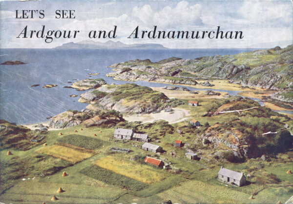
Let’s See. Ardgour and Ardnamurchan was published in two editions, each printed by another company. Both editions have no date with W. S. Thomson, Corpach, Fort William as the publisher’s address. The two booklets were published in the 1950s, but after 1951 when Thomson moved to Corpach, and are part of a 1940s-1950s series of about 20 oblong A5 format booklets on different regions of Scotland.
Although his two books on Scotland with a series of colour photographs, that pictured the highlights of Scotland, the Let’s See series gave a more detailed view of a particular region. In both editions, one printed by C.J. Cousland & Sons, Printers, Edinburgh, and the other The Munro Press Ltd, Perth, Scotland, as the printer, all the photographs except the front and back cover are in black and white. Only the photo of Ardnamurchan Lighthouse on page 19 is different in the two editions.
Both booklets have the same accompanying story written by Andrew [Andy] Paton a photographer living in Fort William, known for a series of panoramic photographs, taken in Lochaber.
William S. Thomson (1906-1967) was a Scottish photographer who roamed his beloved country for thirty years in the 1940s, 1950s the 1960s. He lived in Glasgow, Orkney, Fort William, Corpach and Edinburgh. He published two pictoral books, The Highland in Colour, published by Oliver & Boyd in 1954, and Colourful Scotland, from the same publisher in 1956. Thomson also produced about 20 smaller booklets, focused on different regions, in the Let's See Scotland series. For Travel in Time I rediscover the Highlands and wonder in Thomson's footsteps.
The areas of Ardgour, Ardnamurchan, Moidart, Morvern and Sunart form the West Highland Peninsulas. It is a fairly remote and unspoilt region in the Scottish Highlands, tucked away between Fort William, gateway to the Caledonian Canal, Loch Linnhe, with a magnificent view on Ben Nevis, the Sound of Mull, separating the Isle of Mull from the most westerly point of the British Mainland, and the sea surrounding The Small Isles: Rum, Eigg, Muck and Canna.
The most southern area, the Morvern, feels like the most deserted, mainly mountainous with one main single track road (A 884) leading to the Lochaline village, where a ferry crosses the Sound of Mull to Fishnish, nothing more than a small terminal on the Isle of Mull.
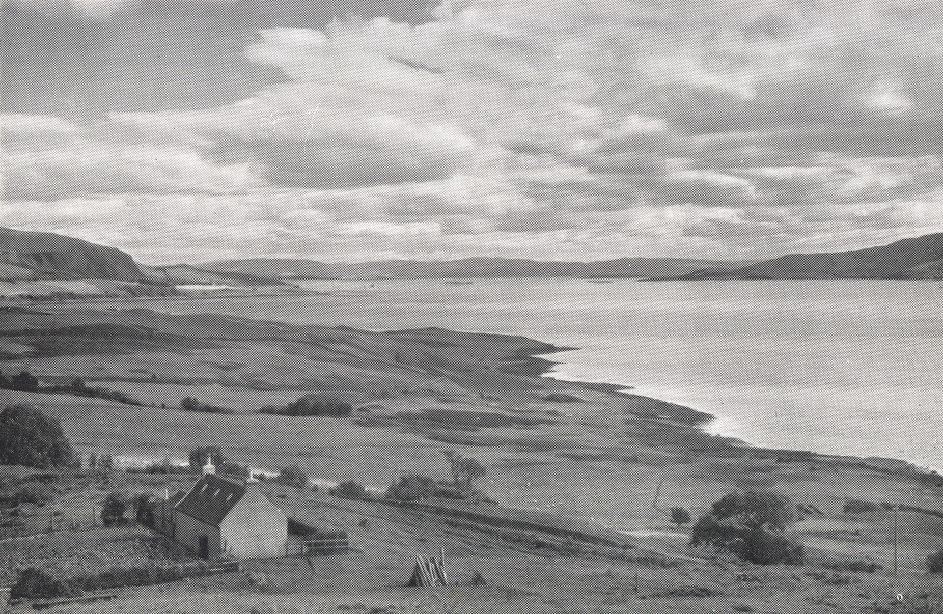
William S. Thomson selected for his booklet Let’s See – Ardgour and Ardnamurchan three pictures in the Morvern, printed in black and white on the last pages of the booklet. The first a few miles up a long dead-end road to the Drimnin Estate with a marvellous view to the east on the Sound of Mull, the second focused on Loch Aline with Ardtornish House, the main manor of Ardtornish Estate, in the distance, and the third one a few hundred footsteps from the Lochaline ferry terminal along the east side of Loch Aline.
The view from the south shore of the Morvern on the Sound of Mull is breathtaking. There is an 11 mile long narrow dead-end road (B 849) from Lochaline to the hamlet of Bunavullin, slightly swirling 20 metres above the coastline, along pastures, through small woodland areas and driving past a house now and then. For the first picture, Thomson did drive 3 miles on this road and parked his car just before Achnaha. From there he did ascend about 10 or 20 metres on foot, taking this picture…

Finding the spot where he probably parked his car, I had the impression the small house was demolished. But back home, editing the picture, it became clear I had to make the extra effort to head a bit higher on the slope. The view matches perfectly but the mouth to Loch Aline on the left is clearly wider.


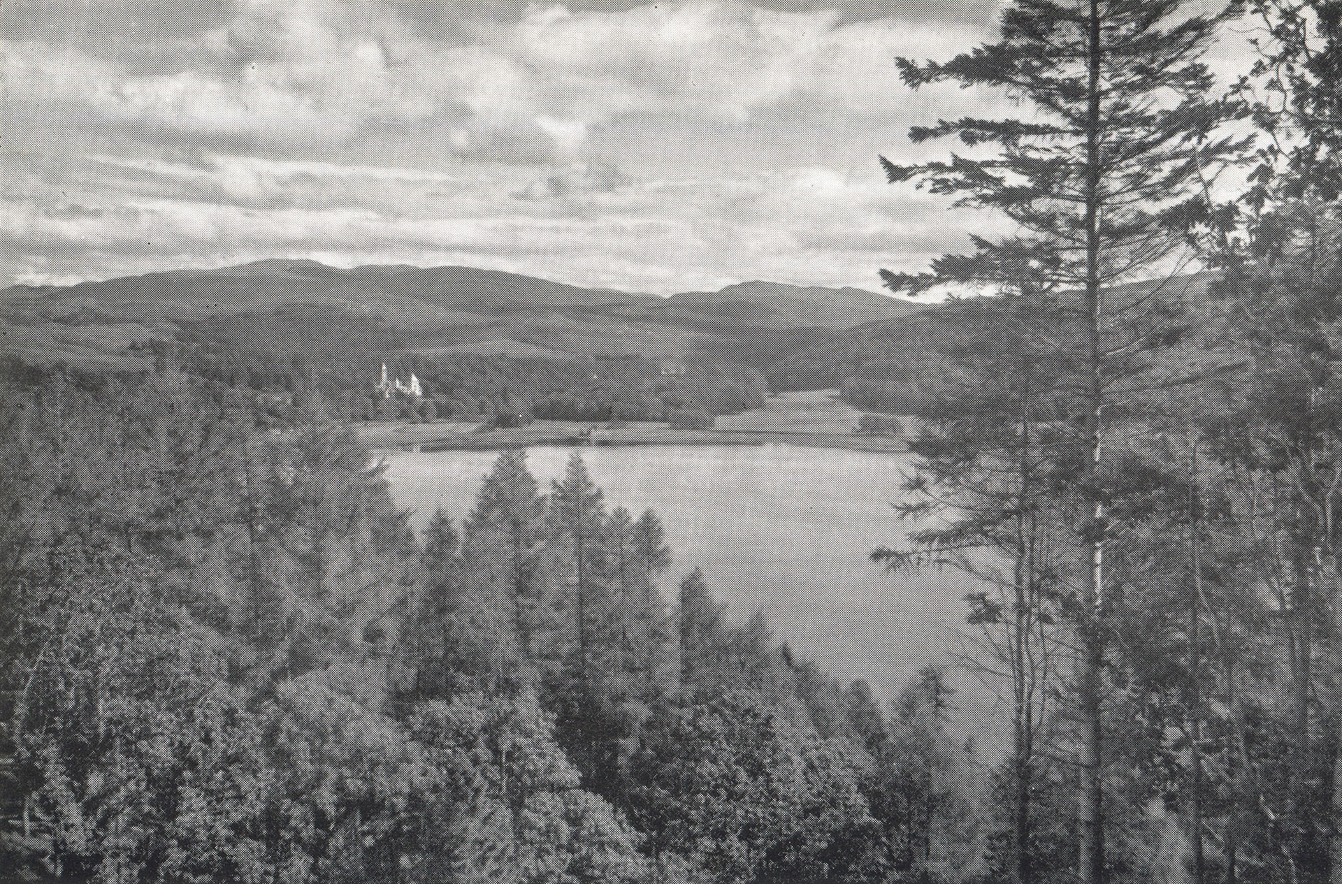
For the second picture, Thomson found a spot along the main road from Strontian to Lochaline (A 884), a few miles before entering the village, with a view on Loch Aline and Ardtornish House. His booklet’s caption wrongly identifies the building as Kinlochaline Castle, which lies a bit to the west, just left from his photograph. The building is Ardtornish House.

The place where Thomson stood for this photograph is now located off track because in the 1970s the road was partly relaid and altered. The location is also much more north, about a few hundred yards, hidden in full-grown conifer trees, along the still existing old road now used for transport of felt trees. I found a spot with a gap at the side of the new road, where the trees were cleared a week earlier.

You can see the hills in the back lie more to the right side of the picture when fixing the picture on Ardtornish House. Also, the distance between the house and the old boathouse, the tiny building to the left along the shore of Loch Aline, is smaller.

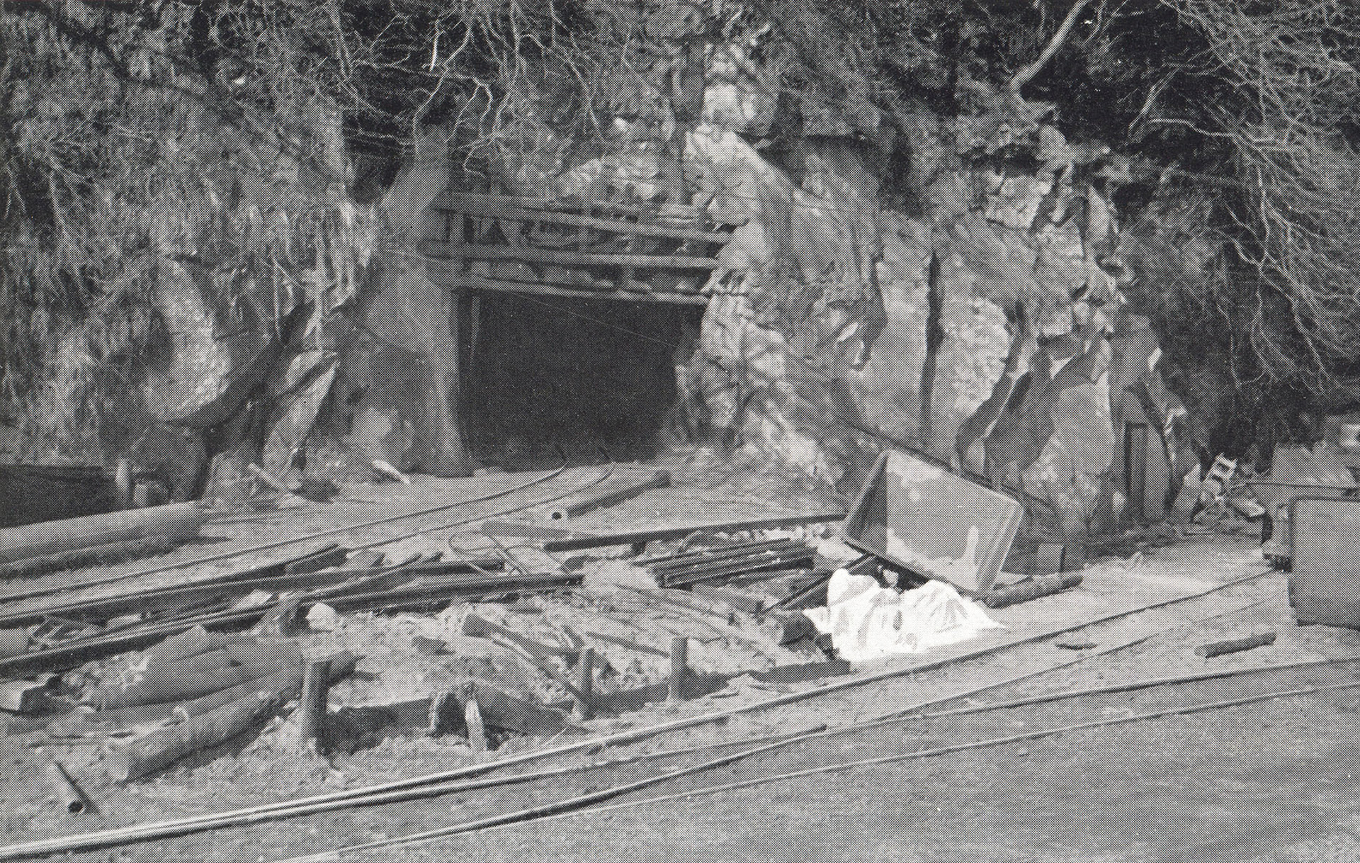
The third Morvern picture is an atypical Thomson photograph. No landscape, but just a small man-sized entrance blasted in the granite shell which covers a vast volume of quartz sand, mined to get the finest quartz quality, suitable for optical purposes and camera lenses.

At the end of the 19th century, Lochaline was mentioned as a potential source of silica sand, with a vast deposit of white cretaceous sandstone running inland from the Lochaline shore. More than 25 years later, in 1923 the Edinburgh Geological Survey analysed a sandstone sample. Although it proved to be one of the purest deposits in the world, at that time the extraction of the Lochaline sand was considered to be uneconomic. Imported silica sand was quite cheap, until World War 2 when other sources of silica sand were cut off, and pure silica was needed for the production of high-quality glass for periscope lenses and gun sights, that Lochaline mine was opened. In 2008 the owners of the mine decided to close the mine, but in 2011 a joint venture between an Italian mining company and a global glass manufacturer was created, reopening the Lochaline sand mine in 2012.
Walking the road from the Lochaline ferry terminal up to the mine office building and further to the sailing boat harbour, some of the old mine entrances can still be spotted. Although altered after the 1950s, when Thomson visited the site.


The pictures then and now in the Let's See series can be found on the map Travel in Time. Click on the link, select at the filter for Landscapes and resize the map looking for Scotland. There you will find the green binocular icons. Please keep in mind the series is a work in progress.
One response to “W.S. Thomson – Let’s See – Ardgour and Ardnamurchan”
Hello, I have been sent a post/link for talk you doing in Fort William re:-W S Thompson old photo’s of Scotland. in particular the one showing Glen Nevis in 1950’s and your’s in 2022. I have a oil painting that was done by my mothers uncle for her that is almost an exact match as the old photo (without the chap in the foreground). He was known to paint form postcards as a pastime. I have 3 other oil paintings, 1 is certainly Urquhart Castle on Loch Ness, the other 2 I’ve been unable find the location of. Thanks to your post/link I now know without doubt that 1 was done from W S Thompson photo although I haven’t been able to find which publication it is in. I have managed to obtain a copy The Highlands in Colour and it doesn’t contain any photo’s of the 4 oil paintings. After seeing your post/link I am convinced (rightly or wrongly) that they are for W S Thompson photo’s, is it possible to point me in the correct direction where I can view more of his work.
Kind regards,
Ian Stansfield.